

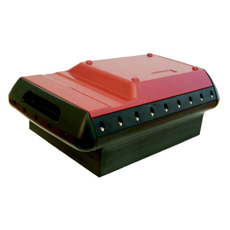
Latest Innovations in Multibeam Echo Sounder Technology
Introduction
The field of hydrographic surveying and underwater mapping has experienced rapid transformation in recent years, largely driven by advances in acoustic sensing systems. Among these, Latest Innovations in Multibeam Echo Sounder Technology have become a cornerstone for improving the accuracy, efficiency, and resolution of seafloor mapping. These systems are widely used in marine navigation, offshore construction, environmental monitoring, and oceanographic research.
Multibeam echo sounders (MBES) use sound waves to map the seabed by emitting multiple beams of acoustic energy and measuring the time it takes for echoes to return. The evolution of this technology has significantly expanded its capabilities, allowing for deeper exploration and more precise data collection than ever before.
Understanding Multibeam Echo Sounder Technology
Before diving into the Latest Innovations in Multibeam Echo Sounder Technology, it is important to understand how traditional systems work. A multibeam echo sounder is typically mounted on a ship’s hull or a remotely operated vehicle (ROV). It sends out fan-shaped sound waves that cover a wide swath of the seabed.
When these sound waves hit the seafloor or underwater objects, they bounce back to the receiver. By calculating the travel time of each beam, the system generates a detailed bathymetric map.
Traditional systems were limited by resolution, depth accuracy, and data processing speed. However, modern advancements have significantly improved all of these aspects.
Key Innovations in Multibeam Systems
1. High-Frequency and Ultra-High-Resolution Beams
One of the most significant improvements in modern MBES systems is the use of higher frequency beams. These allow for:
- Greater detail in shallow water mapping
- Improved detection of small underwater objects
- Sharper image resolution of seabed features
The Latest Innovations in Multibeam Echo Sounder Technology have enabled surveyors to achieve near-photographic quality maps of the ocean floor.
2. AI and Machine Learning Integration
Artificial intelligence is playing an increasingly important role in underwater mapping. AI algorithms can now:
- Automatically classify seabed types
- Filter out noise and irrelevant signals
- Enhance data accuracy in real-time
Machine learning models also help in predicting underwater terrain patterns, reducing the need for manual interpretation and speeding up survey workflows.
3. Improved Beamforming Technology
Beamforming has seen significant refinement in recent years. Modern systems now offer adaptive beam steering, which improves signal clarity even in challenging underwater conditions such as:
- Strong currents
- High turbidity
- Complex seabed topography
This advancement ensures that the Latest Innovations in Multibeam Echo Sounder Technology deliver more reliable results in diverse marine environments.
4. Compact and Energy-Efficient Designs
Another major trend is the miniaturization of MBES hardware. Today’s systems are:
- Smaller and easier to deploy
- More energy efficient
- Compatible with autonomous underwater vehicles (AUVs) and drones
This has made it possible to conduct surveys in previously inaccessible or hazardous environments.
Applications of Modern MBES Technology
The Latest Innovations in Multibeam Echo Sounder Technology are driving progress across multiple industries:
Marine Navigation
Accurate seabed mapping is essential for safe ship navigation. MBES systems help update nautical charts and identify underwater hazards such as rocks, wrecks, and sandbanks.
Offshore Energy
Oil, gas, and renewable energy projects rely heavily on precise underwater surveys. Wind farm installations, in particular, require detailed seabed analysis for stable turbine placement.
Environmental Monitoring
Researchers use MBES to study marine ecosystems, coral reefs, and sediment movement. High-resolution mapping helps track environmental changes over time.
Defense and Security
Naval forces use advanced echo sounders for mine detection, submarine navigation, and underwater surveillance.
Integration with Autonomous Systems
One of the most exciting developments in the Latest Innovations in Multibeam Echo Sounder Technology is their integration with autonomous platforms such as AUVs and unmanned surface vehicles (USVs). These systems can operate without human intervention, collecting data in deep or dangerous waters.
Benefits include:
- Reduced operational costs
- Increased survey coverage
- Enhanced safety for human operators
This integration is revolutionizing ocean exploration and data collection methods.
Future Trends in Multibeam Echo Sounding
Looking ahead, several emerging trends are expected to shape the future of MBES technology:
Real-Time Cloud Processing
Data collected from surveys will increasingly be processed in the cloud, enabling instant access and analysis from anywhere in the world.
Enhanced Data Fusion
Combining MBES data with LiDAR, satellite imagery, and sonar will produce even more detailed underwater models.
Greater Automation
Fully autonomous survey missions will become more common, with minimal human input required.
The Latest Innovations in Multibeam Echo Sounder Technology suggest a future where underwater mapping becomes faster, more affordable, and more accessible to a wide range of users.
Conclusion
The evolution of multibeam echo sounders represents a major leap forward in marine science and engineering. From improved beam resolution and AI integration to autonomous deployment systems, these advancements are reshaping how we explore and understand the underwater world.
As highlighted throughout this article, the Latest Innovations in Multibeam Echo Sounder Technology are not just incremental improvements but transformative changes that are expanding the boundaries of ocean exploration. With continued innovation, the future of seabed mapping promises even greater precision, efficiency, and insight into the mysteries of the deep sea.
